On the coast, in a landscape of instabilities and ambiguities, there are surprisingly three things that are constant. Firstly, sea level is rising. Secondly, a huge percentage of the global population live along the coast, a number that's steadily rising. Even if hurricanes after hurricanes after hurricanes kept pummeling their cities of ramshackled hovels, they will not budge. So rather than retreating, they will dig themselves deeper and deeper. And thirdly, they will entrench themselves by basically building walls.
Unlike a similar project further up north, the Tulip Island in the Netherlands, and even the Palms of Dubai, this archipelago will be “based on morphological logic.” Instead of plopping down “arbitrary geometries,” the islands will be “built up from existing banks in the North Sea, using the current morphology to determine their placement.” Instead of isolating themselves, they will be opened up to the dynamic flows of the landscape. They will be “North Sea-specific.”
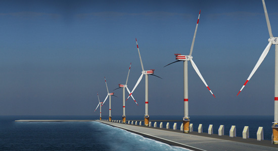
Once divined out of the sea, these extended coastlines will host natural reserves and sanctuaries for migrating wildlife, windmills and “dune villages.”
Meanwhile, we are of the persuasion that managed retreat is the best of possible solutions to coastal erosion and future inundation by sea level rise. What possible benefits local businesses and the heritage preservation police get from fortifying themselves in concrete are offset by the massive infrastructural cost needed, a multi-decade investment now even more unsustainable in the current financial crisis. And if past projects are anything to go by, what gets built will create more problems than it's supposed to solve.
But we're thinking of the eastern seaboard and the gulf coast of the United States. We don't know much about the coastal geology of Belgium. Sea level rise by climate change may be global, but hyperlocally, it will manifest itself in ways as myriad as the varying geomorphological conditions at every stretch of every coastlines. So maybe this artificial archipelago will work. It's already been conceptualized as anti-Dubai, so it rests on a good footing.
As reported today in New Scientist and elsewhere, the same basic principles used in recent experiments to render objects invisible at least in some parts of the electromagnetic spectrum have been employed to develop a dike system that can shield objects they surround from water waves.
This system is composed of “concentric rings of rigid pillars.” Waves passing through its “labyrinth of radial and concentric corridors” are not cancelled out but rather are reconfigured (re-sculpted?) in such a way that they pass through the object inside with little or no effect.
If this scheme can work in scaled-up versions, it may well protect vulnerable coastlines, entire islands and offshore oil platforms from destructive tsunamis.
While acknowledging the skepticism of so many directed at this tsunami cloaking device, we have to confess to being quite mesmerized, to the detriment of our rational faculties, by the incredibly poetic image of these barriers submerged in the gloomy depths: a flooded forest of concrete colossi diffracting sunlight into its own prismatic corridors.
Perhaps they've been turned into artificial coral reefs to generate some ecotourism income to diversify the local economy and offset construction costs. Or maybe they've been topped off with wind turbines. Or both: The Anti-Tsunami Wind Farm and Barrier Reef Wildlife Park. Surely an ideas competition must be held so as to generate other possible programmes.
In any case, it's probably something Peter Eisenman would design if hired by the Army Corps of Engineers.
Thousands of years from now, when the glaciers come to reclaim back territories they had once surrendered and sea levels retreat in response, they will begin to emerge out of the waters: false skyscrapers barnacled with the ossified remains of countless generations of organisms but still retaining their minimalist geometry; a labyrinth of monoliths taking measurements of a landscape in flux but whose true functions have long been forgotten.
“They are memorials to ancient mariners lost at sea,” one of our many-times-great-grandsons will speculate.
“They're astronomical observatories,” another will suggest.
“You're both wrong,” a future crypto-geographer will shout. “It's a contemplative space designed by a 21st century landscape architect, though rather than being used as a place of serene meditation, it became the well-concealed playground of horny teens, drug dealers and rapists, as well as the pissoir of inebriated sports fans.”
Soon afterwards they will shriek in frustration like Kubrickian apes.
Mapping the Ecotone, Ashley Kelly and Rikako Wakabayashi's winning entry in the design competition Envisioning Gateway, is one of those things that we have been meaning to post for months.
Having earlier attempted to communicate our fascination with coastal interventions and our belief that by merely being sited on such tenuous terrain, they are by default the most interesting type of project there is, we think that the duo's project will be a good postcript to our previous post.
Their proposal is certainly among the best that we have encountered last year, and it definitely deserved its First Prize.
Kelly and Wakabayashi had a two-fold task. First, they had to develop a master plan that unifies the separate units of the Gateway National Recreation Area scattered all over the New York-New Jersey harbor. Second, within this larger scale, they had to design a new park at Floyd Bennet Field in Jamaica Bay, the result of which are seen in the images accompanying this post.
A major element of their proposal is a series of jetties and piers, rigid infrastructure in an otherwise shifting landscape. It's the urban edge intersecting with the natural landscape. From above, they look like the runways of the now defunct airport, here realigned not to direct people off to distant locales but to the site itself.
It's a simple design but a fantastically genius one. It allows park visitors to come “into direct contact with marshlands, tides and fluctuating sea levels” but, in keeping with the natural condition of the park, a place in “necessary flux,” this infrastructure vacillates between accessibility and inaccessibility.
In other words, during low water levels, you can throw around a frisbee or have a picnic or take a hike on dry ground; you can do most anything what you can at a national park or an urban park. But when the waters come and inundate the site, there will certainly be some things that you won't be able to do, although you would now be able to fish from the jetties, do some kayaking and more — until, of course, the site reverts back to drier conditions.
The great deluge may have come but there's no reason to panic. The design being as resilient as it is, the infrastructure hasn't collapsed. The symbiotic relation between the varying ecological and cultural systems hasn't deteriorated.
This is disaster, designed.
There is an important lesson here for coastal cities threatened by sea level rise, especially cities like New Orleans. The prevailing paradigm is to separate urban settlements from the waters, to fortify against attacks from the elements. But it's a catastrophic mistake to think that one can contain something as eternally mutable as the landscape. You cannot freeze the outline of the shores or the riverbanks forever in time and place.
What Kelly and Wakabayashi are saying is open up the city to the waters. Give it a zone of transition — an ecotone — where both land and water can be occupied simultaneously.
In the abstract, replace classical notions of formal clarity and structural stability with an orthodoxy of flexibility and adaptibility.
Meanwhile, it must be mentioned that in addition to being points of access, the jetties and piers are pedagogical tools as well. As the landscape changes around them, they provide a backdrop with which one may be able to discern the various habitats, the disappearance and reemergence of landforms, and fluctuating sea levels.
One may even possibly detect the creeping effects of global warming.
Earlier this month, the president of Kiribati warned the nations of the world that his country will be gone by century's end. Submerged under rising sea level, a casualty of climate change.
And even if, by some ridiculously well-timed miracle, everyone reduces their carbon footprint to near zero, the 92,000 island inhabitants “may be at the point of no return” where reversing the effects of the emissions already in the atmosphere will not come before their atolls get flooded. The president thus asked for help in resettling his people.
While very impolitic, he should demand from the worst polluting nations that as an act of “redemption” they should set aside “reservations” in prime real estate, for instance, some of the Hawaiian islands, where the entire population can collectively forge a new set of geographic identitites instead of being dispersed in diasporic communities around the world.
Maybe China is open to the idea of deleting a part of the Tibetan plateau and exporting the pulverized geology to the Pacific. They will, of course, argue that this a form of carbon emission trading.
Or the European Union could give the president an order or two of Vincent Callebaut's Lilypad.
Quoting Archinect, where we first saw this featured.
LILYPAD is a true amphibian - half aquatic and half terrestrial city - able to accommodate 50,000 inhabitants and inviting the biodiversity to develop its fauna and flora around a central lagoon of soft water collecting and purifying the rain waters. This artificial lagoon is entirely immersed, ballasting the city. It enables inhabitants to live in the heart of the sub aquatic depths. The multi functional program is based on three marinas and three mountains dedicated to work, shopping and entertainment. The whole set is covered by a stratum of planted housing in suspended gardens and crossed by a network of streets and alleyways with organic outline. The goal is to create a harmonious coexistence of humans and nature, exploring new modes of cross-cultural aquatic living.
Kiribati would probably need a less pimped out version, unless, of course, they realign their economy away from fish and phosphate towards eco-tourism — which leads us to wonder: will future climate change refugees become a new caste of service sector workers inhabiting a sort of Floating Hotel & Duty Free Mall, the port of call that comes to you, wherein the fine art of the greeting and linen folding is treated as a Masonic secret passed down from one generation to the next?
In any case, some more unabashedly digital images.
Contrary to popular beliefs, Fresh Kills in New York City's Staten Island doesn't contain the biggest collection of garbage in the world. What Wikipedia says “could be regarded as the largest man-made structure on Earth, with the site's volume [...] exceeding the Great Wall of China” and was once the temporary dump site for the remains of the WTC Towers isn't the largest landfill at all.
In fact, the largest landfill isn't even on land, but rather it is trapped in an oceanic riverine system known as the North Pacific Gyre.
Wikipedia again: “The centre of the North Pacific Gyre is relatively stationary and the circular rotation around it draws waste material in. This has led to the accumulation of flotsam and other debris in huge floating 'clouds' of waste, leading to the informal name The Great Pacific Garbage Patch or Eastern Garbage Patch. While historically this debris has biodegraded, the gyre is now accumulating vast quantities of plastic and marine debris.”
It is so vast, apparently, that these floating clouds have a total area equal to that of 2 Texas.
Which directly leads me to wonder: can you collect these patches to create a floating solid ground?
It'll be like a new Pacific island nation molded together out of “80,000 Nike sneakers and boots” and “tens of thousands of bathtub toys and hockey equipment” lost overboard from cargo ships.
Or a recycled ocean cruisers from where eco-terrorists hunt down polluting holiday cruise ships in the high synthetic seas.
Or better yet, dump it all on the Polynesian archipelago of Tuvalu, which Der Spiegel says is “currently only 10 centimeters above sea level” and “likely to become the first country to succumb entirely to climate change.”
Paradise Lost it may certainly be, but it may yet still be Arcadia Regained from the bottom of the ocean.
Of course, the islanders have the option of not anchoring this newly accumulated stratum of detritus to their former nation; they could submit it to the whims of the ocean currents and trade winds.
And in their intraoceanic meanderings, they'll meet other climate change refugees on their own island nations made out of Barbie dolls. A new trade group could be formed, with the goal of developing self-sufficient economies and expanding their territorial boundaries by mining the Pacific for consumer goods Made in China.
Is this the future site of the New Central Park of the Pacific, designed by Fresh Kills head designer James Corner?
In the 1940s, archaeologists discovered the ancient city of Seuthopolis, the capital seat of the Odrysian Kingdom beginning in the 4th century BCE.
Unfortunately, the discovery came too late, because under construction nearby was a reservoir dam, which would soon flood the valley and drown “the best preserved Thracian city in modern Bulgaria.”
Now over half a century later, a project proposed by Bulgarian architect Zheko Tilev would uncover and preserve the ruins using “a circular dam wall, resembling a well on the bottom of which, as on a stage, is presented the historical epic of Seuthopolis.”
Indeed, most everything about the project is theatrical: “Approaching the surrounding ring by boat from the shore Seuthopolis is completely hidden for the eye. But the view from the wall is breathtaking - with its scale, comprehensiveness and unique point of view; from the boundary between past and present. The possibility to see the city from the height of 20 meters allows the perception of its entirety.”
Once there, and if your interest in exploring archaeological sites wanes considerably faster than expected, there are other things to do on the ring-wall. For instance, there will be restaurants, cafes, shops, bike rental facilities, and also other facilities for various recreational sports and fishing.
Programmed as “a unique modern tourist complex,” the ring-wall will also house a museum, a hotel complex, open-air exhibitions, concert and festival halls, conference centers, and hanging gardens.
It's a classic case of horror vacui, in other words.
There are three sites where this should be done as well:
1) New Orleans (i.e., having abandoned the city, its inhabitants now live and work and die on grossly heightened and fattened levees; everyone will laugh at them, but when the deluge comes, they will have the last laugh)
POSTSCRIPT #1: For a different strategy than the one planned to uncover and preserve the ancient city of Seuthopolis, see the planned underwater museum of Alexandria.
In her amazing book Against the Tide: The Battle for America's Beaches, Cornelia Dean recounts all too briefly what Galvestonians did to their city after the hurricane of 1900, a devastating storm that killed nearly 6,000 people and leveled what was then considered “the center of commerce for the entire Southwest” into a mountain of driftwood.
Rather than retreating from the shifting sands to points higher elsewhere, we read that the city instead decided to build a seawall, fencing itself off from future disasters. It then raised everything behind this wall — houses, churches, offices, trees, gardens — by as much as 17 feet, and flooded the revealed negative stratum with silt.
It was a “plan that even in an era of engineering daring stood out for its size, cost, and audacity.”
Quoting pages 6 and 8:
The lifting operation was one of sheer brawn. Laborers ran beams under the buildings and mounted them on screwjacks that burly men turned by hand. In this way, 2,156 buildings were laboriously hoisted, a quarter of an inch at a turn, until they reached the requisite height and new foundations could be built beneath them. Meanwhile, children climbed rickety catwalks to reach their schools; housewives hung their laundry from lines strung fifteen feet above the ground.
Even substantial structures took to the air. At St. Patrick's Church, a three-hundred ton brick structure, services continued as it rose to the grunts of laborers manning two hundred screwjacks beneath it.
To repeat: At St. Patrick's Church, a three-hundred ton brick structure, services continued as it rose to the grunts of laborers manning two hundred screwjacks beneath it!
Once airborne, a proto-Archigram city in quasi-flight, fill was delivered from a canal engineers had dug down the middle of the island.
Day and night, dredges moved back and forth between Galveston Harbor and this canal, dredging up fill from the harbor bottom and spewing it out on either side of the canal in a slurry of water and sand.
There were some residents who did not want to jack up their properties; these same people then witnessed their houses getting “drowned in the slurry of sand.”
The owners of several elegant Victorian mansions declined to subject them to the rigors of the screwjack. Instead they let the pumped sand fill their first reception rooms or turned them into basements. The lawn of one graceful brick house, once surrounded by a ten-foot wrought-iron fence, is now edged by ornamental ironwork about a foot high—the top of the fence is peeking up through the surface of the fill that now surrounds it.
So who wants to take a bet on when Galveston will get jacked up again?
Or for that matter, when will it be done to New Orleans, Dakha, Venice, New York, and every other major cities in the world threatened by sea-level rise?
An interesting article about another construction boom was published yesterday in the The New York Times.
Some countries have strategic oil reserves; others stockpile rice or wheat. The island nation of Singapore has emergency reserves of imported sand.
The sand is there to secure Singapore’s insatiable demand for concrete, a reminder of its vulnerability as a nation without a hinterland to supply it with vital resources.
The government is now being forced to tap its sand hoard after its usual supplier, Indonesia, abruptly banned exports in February, citing the impact of a recent Singaporean construction boom on Indonesian beaches and island environments.
The ban touched off the latest in a string of disputes between Singapore and its neighbors over water, land reclamation, satellite concessions, corporate takeovers and the flight patterns of the Singapore Air Force, just to name a few.
In searching for more background on the embargo, we learned that the vast majority of sand Singapore imports go to land reclamation projects for new beaches, industrial parks, commercial and housing development, port and airport facilities, and other important infrastructure. Over the last four decades, these projects have increased the country's land area by nearly 20%, and more are planned in the coming decades.
This territorial expansion, however, came at the expense of its own hills — not very tall ones, but hills nevertheless — which have been sheared flat, their truncated peaks dumped into the sea. And then there are the islands in the Malaysian and Indonesian archipelagos, some of which are now in danger of disappearing, if not already fully submerged beneath the waves. Moreover, large tracts of mangrove forests along the coast were consequently destroyed — suffocated by a flood of pulverized hills and islands, as it were, soon to be followed by another deluge, courtesy of global warming.
Indonesia previously banned such exports, but a robust trade in illegal sand did little to curb the environmental degradation. If anything, this geological thievery provided for some curious incidents on the high seas. For instance, back in 2002, the Indonesian navy sent two warships to capture seven vessels suspected of smuggling sand to Singapore. Not banned military technology or illegal immigrants or weapons-grade enriched plutonium or even an actual atomic bomb — but sand.
(24: The Movie? You buy a MacMansion in a remote barrier island, but the beach behind your house isn't quite up to your standard of an ocean-side paradise. Thus, you decide to purchase several tons of sand, precipitating an action-packed thriller half-way around the world involving your landscape architect, geologists, shadowy international trade syndicates, government trade ministers, corrupt provincial governors, local paramilitaries, environmentalists, fugitives, container ships staffed by multinational sailor-for-hires with dubious histories, warships, dredgers, and, yes, illegal sand. Of course, Jack Bauer will have to navigate through all the assorted plot points to prevent a disruptive regional conflict from erupting.)
Anyway, to go back to Singapore's emergency stockpile, the image of mountain ranges made up entirely of finely grained immigrant soil, rising and diminishing in response to economic demands and international geopolitics, within or along the periphery of a crowded metropolis, is outrageously fascinating. At the very least, it might inspire an interesting art installation.
Javanese hills and Bornean ridges simulating Singapore's erased topography.
Remember the Sundarbans, that “tapestry of waterways, mudflats, and forested islands at the edge of the Bay of Bengal” and home to an unbelievably huge array of endangered species? The Independentreported last month that one of the inhabited islands there, Lohachara, has “disappeared beneath rising seas.”
“Eight years ago,” we further learn, “the first uninhabited islands - in the Pacific atoll nation of Kiribati - vanished beneath the waves. The people of low-lying islands in Vanuatu, also in the Pacific, have been evacuated as a precaution, but the land still juts above the sea. The disappearance of Lohachara, once home to 10,000 people, is unprecedented.”
So while global warming is uncovering islands elsewhere, it is expected to wipe out about a dozen or so inhabited islands in the Sundarbans in the very near future, resulting in an estimated 70,000 sea level refugees.
The Sundarbans, in other words, couldn't be a more perfect setting for The Army Corps of Engineers: The Game.
As originally and inadequately fantasized here, you as a game player will be given an island, forested or slightly so, but intentionally inhabited so as to give your choices and actions an element of real consequence.
Without intervention, your tropical paradise will be wholly submerged exactly ten years from the start of play. And lest some bothersome Republican Apologist or a second-rate SF novelist obfuscate the science, the data predicting catastrophic sea level rise is irrefutable, its analysis impeccable and unassailable.
Per island is a lone seaside village. You will notice that its plan closely follows the principles of New Urbanism. This is probably because the principal game designers have read too much Nicolai Ouroussoff and consequently have turned homicidal and, like CIA expert waterboarders to a terror suspect, would like nothing more than to see anything that is quaint and earnest placed under simulated drowning and environmental stress, with the possibility of stylistic expiration or total erasure. That or perhaps they have been proselytised by Andrés Duany enough to have developed a raging hero complex for things wholesome and bourgeois.
But whatever.
The waters are coming, and you are tasked to prevent your designated island and its village from sinking.
You will have a budget of $1 trillion, of course, and have all the structures and widgets ever used in the long history of hydroengineering — from the Garden of Eden to the Three Gorges Dam — to choose from: groynes, seawalls, revetments, rip raps, gabions, breakers, levees, dams, canals, bridges, channels, spillways, pumping stations, marram grass, artificial reefs, imported sand and fleets of trailing suction hopper dredgers.
As this is being sponsored by IKEA®, the challenge will be in their assembly.
Since you'll be taking on the role of Chief of Engineers and the rank of lieutenant general, you will command an army of migrant workers from Southeast Asia and the Subcontinent. Choose carefully among the enlisted, since each nationality has been genetically altered to display certain traits.
For instance, the Vietnamese are supremely creative, prone to fits of the imagination. The Thais, meanwhile, are practical and reliable, but there are instances when they get distracted completely. Filipinos are the most collegial and unlikely to disrupt your schedule to air out grievances on their quasi-indentured status. The Laotians are the most hardworking, though sometimes they can be too Western about certain things, namely wages and working conditions. The Indonesians have undertaken the most extensive training, but unfortunately, they lack imagination. The Bangladeshis hate the Indians and vice versa. Everyone dislikes the Pakistanis.
Again, draft wisely, for when the tenth cyclone of the season is on a direct course towards your island, the right mixture of skills and a collaborative team atmosphere will help you weather the flood.
With the grunt work placed on the shoulders and backs of others, you'll have time to strategize. So if you like, you can invite Cornelia Dean and Lieutenant General Carl A. Strock for a candlelight dinner to gather some pointers and maybe even create a cheat sheet. After desert and a fine digestif, you hold a seance to channel Arnold de Ville and Salomon de Caus. Alternatively, everyone gathers around the bonfire on the beach and take turns reciting stories from The Deluge.
You could even organize a weekend charette or a hydrologically-themed lecture (and film) series. For something that's a bit more rigidly curated, you can host an international symposium showcasing the latest hydroengineering research by leaders in the field. Perhaps a design competition can coincide with this event. Countless students and emerging young firms — everyone oozing with talent, vigor, and infectious enthusiasm to make even the most cynical archiblogger weep for joy — will all send in wildly radical yet uncannily practical designs. Of course, your chosen jury will unfortunately have decided long before that they will only going to pick the OMAs and the Hadids and the Schwartzes and the Walkers. They'll laugh; so too will the Pritzker Laureates and the FASLAs. (Unless perhaps you're Rem Koolhaas and decide to throw a fucking hissy fit.)
Or at night, with the impending sea softly breaking against the dunes, you reflect upon the monumental task of lifting Venice above the lagoons for inspiration.
While still clinging on to the pretense that this game is real — and temporarily setting aside the fact that this post wasn't published primarily to point you to The Independent article, but rather to provide a dumping ground for 1) leftover images of TSHDs from this previously mentioned post; 2) some newly collected images of tetrapods; and 3) various links collected last year — here are some prohibitions:
3) You cannot use any part of your budget to embark on a worldwide conservation crusade or to fund research into alternative, non-polluting forms of energy.
4) Your island must remain tectonically stationary, as opposed to airborne.
5) You cannot mechanize your island and install too many A.I. systems that it becomes sentient.
6) It goes without saying that a strategy of managed retreat — arguably the most sensible but, inexplicably, rarely implemented planning approach to future coastal disasters — is not allowed, because that would be too easy.
So if this were indeed a real game, whoever keeps their island with roughly the same pre-game acreage above sea level the longest, wins.
That your construction looks like a Rube Goldberg machine or a psychosis-inducing theatrum machinarum will not count against you. In fact, you might be awarded a Jury Prize.